
Landwatership
The State or Condition of being Landwater
Project by Mark Zygadlo
Landwatership proposes that the vital and fundamental elements of our environment, land and water, are active members of our localised communities. It presupposes that no part of our environment is unaffected by human presence and no part of us is unaffected by our environment. These factors have been foregrounded during the Covid-19 pandemic.
By focusing on the Glenmidge Burn, and the community of its catchment, walking the waterways and the catchment boundary guided by members of the community and representatives of riverine interest, Mark will interrogate the theory of Landwatership.
Information gathered will underpin a conceptual re-mapping of where we live and ask: is Landwatership a meaningful way for communities to co-identify themselves with place? Is it a matrix of change, can it help us address the tensions between global economics and local viability? Does it provide a way of addressing the approaching threat of climate change foreshadowed by the Coronavirus Pandemic?
For information about Mark, visit our Participants page.
Chapter One: Maps
The following series of maps and notes follow the progress of an investigation, part of the Atlas Pandemica project called, Landwatership.
Mark is interested in feedback from people looking at the series of future maps. These are speculative by nature and hope to open a conversation about the shape of things to come. They are therefore open to suggestion and reconsideration, they can be changed, added to or completely rethought. It is open to everyone to help shape the future. To add your thoughts, get in touch by email to [email protected].
Map 1.
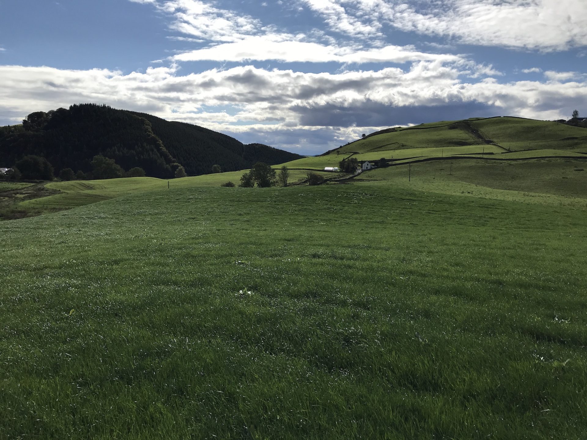
The base map is part of the 1843 OS sheet XL, at a scale of 6”:1 mile. This is a very accurate map and it is surprising how little has changed in the area in the 163 years since it was published. This may be due to the topography which does not lend itself easily to development either in agricultural or industry. The pressures for development even in domestic building have been slight in this fairly sparsely populated rural area.
This is the first of a series of chapters which will accompany the following maps explaining the developing layers of information contained in them and addressing the idea of Landwatership. To look in detail at the maps, please use the website maps which are zoomable.
This first chapter is general, explaining, I hope, the reasoning behind this approach to an in-depth look at my home turf through the lens of the Covid19 pandemic and climate change.
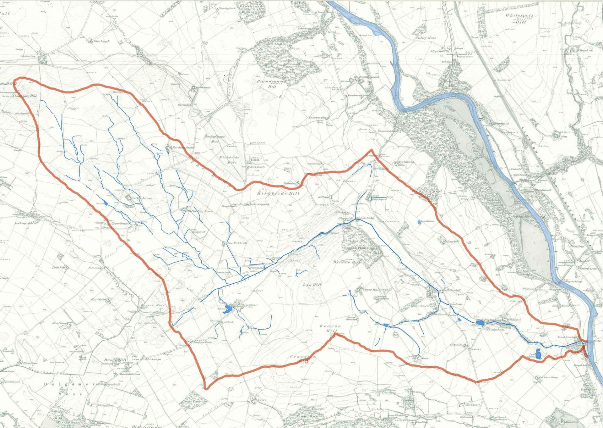
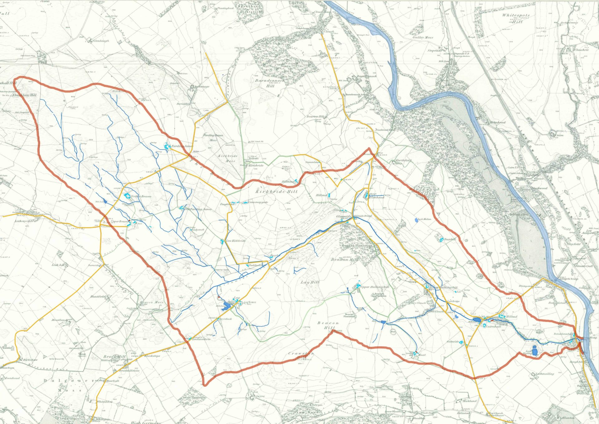
Map 2.
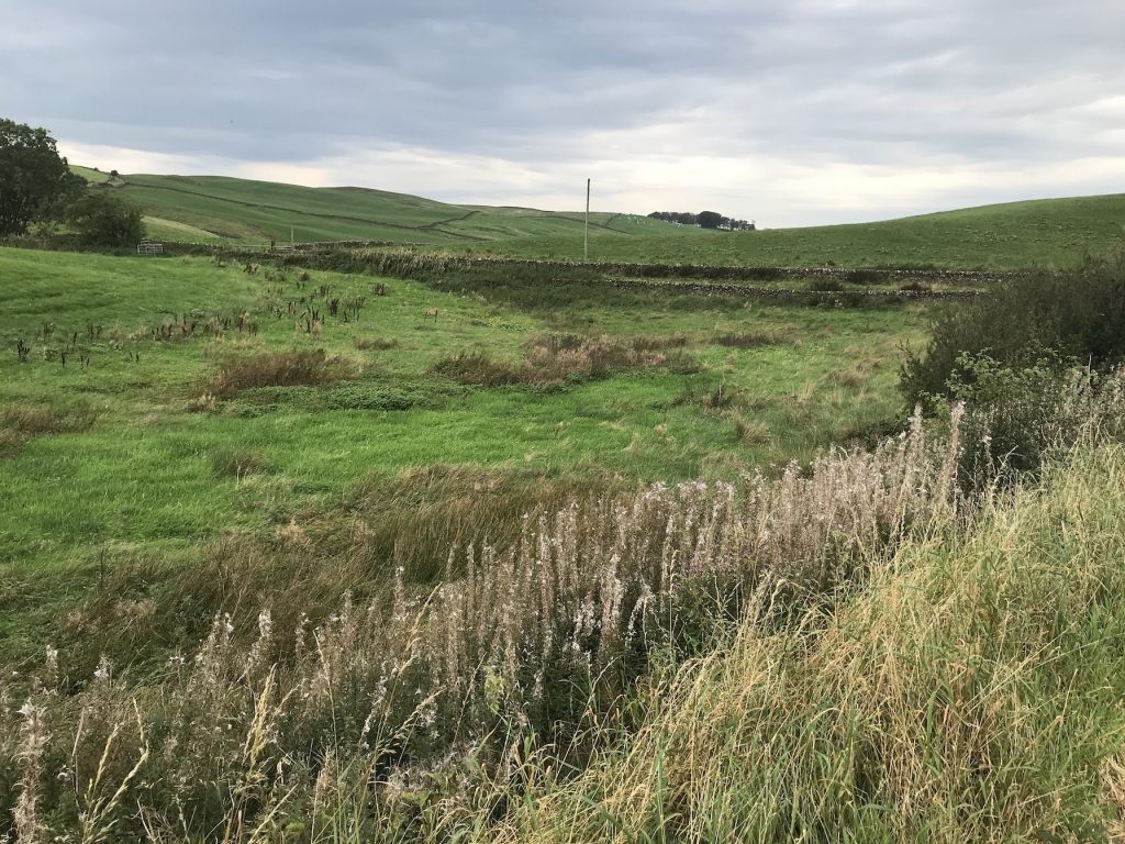
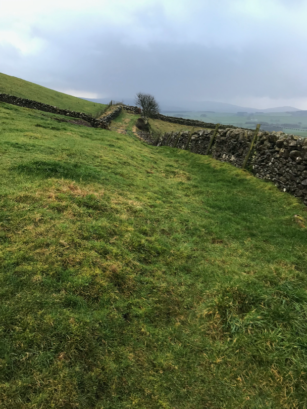
Base map + Glenmidge Burn catchment area and the waterways.
The red line is the catchment watershed.
Glenmidge Burn Water Data:
| Area of the Catchment | 7.7 Km2 |
|---|---|
| Annual rainfall | 1219mm |
| Volume of water falling on the catchment p.a. | 9,386,300 m3 (tons) |
| Percentage run-off | 62.66% |
| Glenmidge Burn run-off into the Nith | 5,881,455 m3 (tons) |
Elevation:
| Fleuchlarg Hill, (NW of Catchment) | 281.9m (925ft) |
|---|---|
| River Nith at Glenmidge Burn issue. | 22.8m (75ft) |
| Fall | 259.1m (850ft) |
The catchment was drawn by walking the watershed with a mobile phone app. called, ‘Viewranger’ which tracked my movement. There were a couple of stretches I could not walk so the watershed was drawn in using the contour lines on the map. A bull occupying a single field near Hillhead looked discouragingly on my research intentions, and I was not given permission to walk over the stretch across the drumlins* between Braco and Lochmederie. The line of the catchment over this latter stretch is very difficult to assess even if I had been able to walk it. The drumlins cover a generally low-lying gravelly area which floods between the hillocks when the water-table rises after rain. As the definition of the catchment is about the direction water flows off the land, and this area is a sort of underground lake from which water drains both East to the Glenmidge catchment and West to the Cairn via the Birkshaw Burn, any line drawn across it is superficial.
*Drumlins, a topographical feature of landscape quite common in mid Nithsdale, are created under a glacier as it moves over the ground. They are characterised as clusters of gravelly hillocks. In the maps this area is the Southwestern part of the catchment between Braco, Lochmederie and Lag.
Map 3.
Map 2 + 1843 habitations, Mills, Road and Pathways.
Population estimate.
All footpaths from the 1843 map are shown in green even though many of these have now disappeared through disuse.
The relationship between roads and footpaths is instructive. In a rural area without public transport services where every household now has at least one car the use of footpaths over the last 50 years has declined and many have disappeared. In Scotland the public has the right to walk anywhere, within reason, and ironically, this right has meant that the maintenance of footpaths as rights of way has not been kept up. By contrast, in England, where there is no public right of access to the land, the maintenance and use of footpath rights of way have been defended more energetically.

Map 4.
Map 3 + 2020 habitations + Woods.
Demographic 2020:
| Catchment Households | c.45 |
|---|---|
| Estimated population | 97 – 105 |
Name Changes.
Modern ‘Glenmidge’ is a derivation of Glenmids (1843)
As well as there being new and altered habitations and farm buildings, houses or farms have also changed names, notably:
Faughland (1843) is now Kirkbride Farm.
The ruin of the original Kirkbride Farm and the historic site of Killbride are shown on the 1843 map but not named on modern OS maps.
Low Hallidayhill (1843) is now called Barndarroch.
Ronaldstone (1843), at the Glenmidge’s issue into the Nith, is now called Rhonestone
Bracco (1843): there are many variations on this name. Older maps show the drumlined area between Lochmederie and Bracco farm as the Breccoes, Braco, Freccars, Breacocks, which seems to refer to the topography.
Current land use (est.):
| Total area | 7.7km2, (770 hectares, 1902.7 acres) |
|---|---|
| Grazing 80% | 616 hectares |
| Softwood plantation 15% | 115 hectares |
| Other(houses, bog, etc.) 5% | .38 hectares |
Light green areas indicate softwood plantation. Darker green areas are mixed or hardwood areas. The area on the SE and E slope of Kirkbride Hill is a proposed mixed area and an adjacent shelter belt N. of it. These are planned but not yet planted.
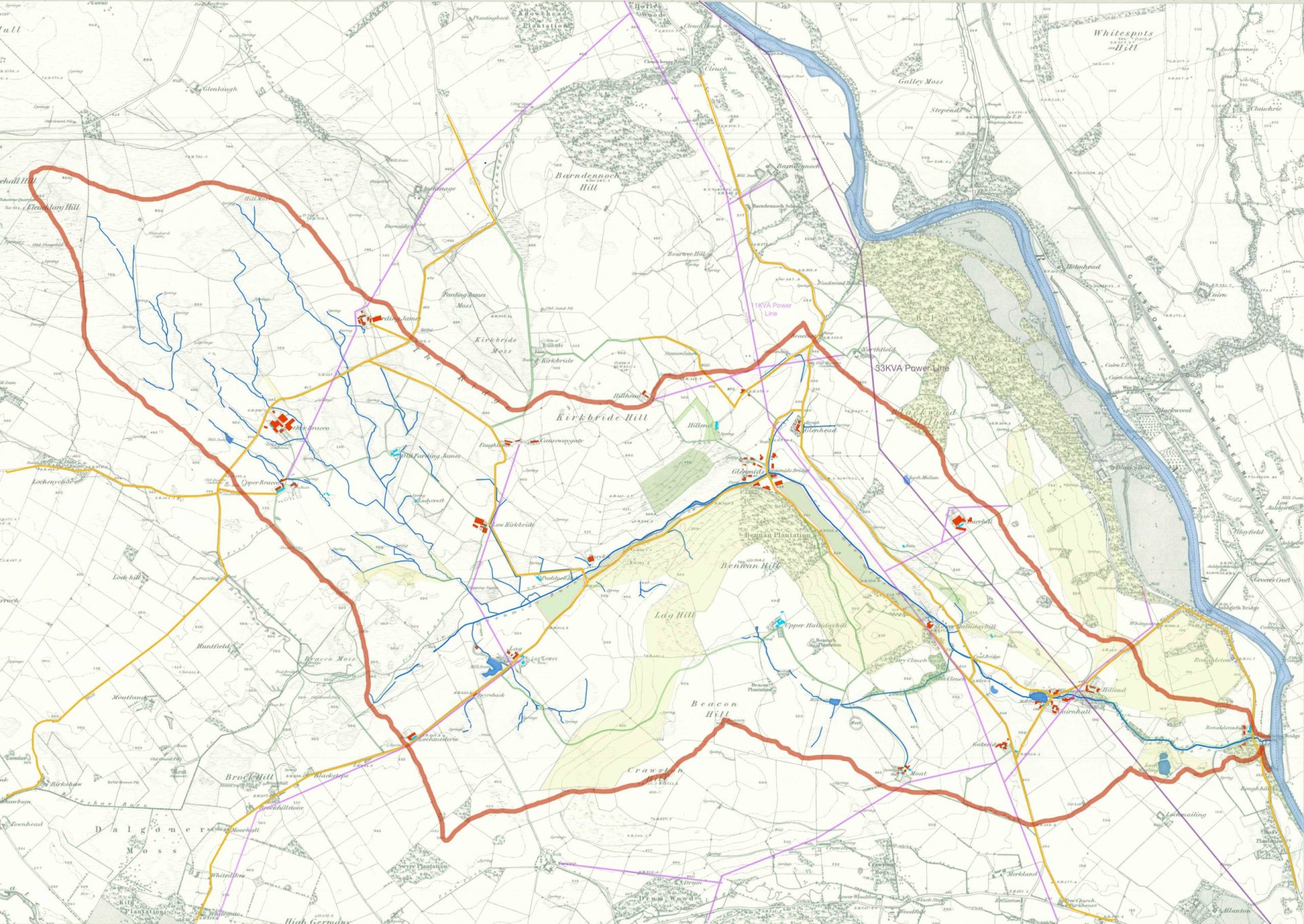
Map 5.
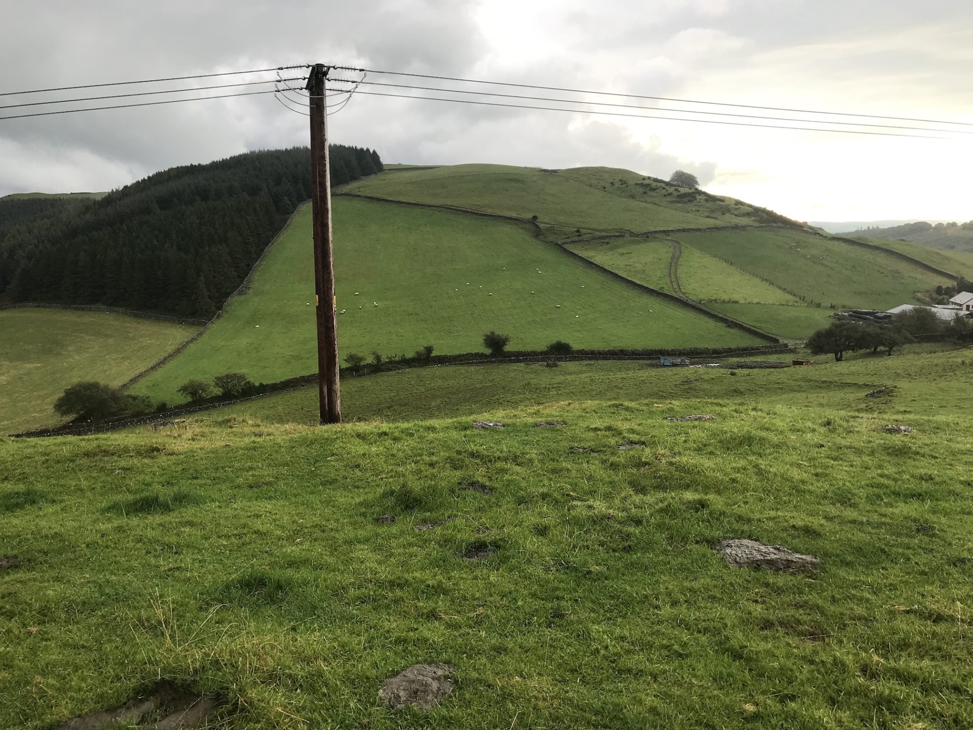
Map 4 + Powerlines
A 33KVA power line runs along the Eastern edge of the catchment. After crossing the road at Hillend, it follows the ridge up Blackwood Hill then descends sharply towards the River Nith, following it north towards Thornhill.
An 11KVA, 3 phase line runs parallel to this to the West along the bottom of the glen towards Glenmidge then rises up over the pass near Glenhead and down again towards Barndennoch. Short branches supply both sides of the glen and a longer branch supplies the Northwest part of the catchment, both the Bracos and Fardingjames, coming back over Barndennoch Hill via Auchenage.
The centre of the catchment is supplied from Dunscore by a line running beside the road that enters the catchment at Lochmederie, thence to Lag, then North across the drumlins to the Kirkbrides.
Threshold
Up to this point the maps have shown what exists in the catchment. Map 6, the next one, is the first to speculate about changes the future may bring. This speculation is based on observations of behavioural changes starting in March 2020 with the Covid19 outbreak, on conversations with residents of the catchment and on the perceived influence climate/environmental change may have on the character of the catchment in the future.
This requires a bit of explanation. The opening proposal was to consider land and water as a matrix in which all forms of life are embedded, human life no less than any other. The use of maps as the medium of investigation and, possibly, of expressing the outcomes suggests itself because the shape of the land, as we see and experience it today, is a palimpsest; it contains within it evidence of past changes, from eroding tectonics through to annual replanting, and successive maps reflect this. They are also, as indicated above, a way of considering the future; a map of tomorrow’s catchment is another layer of the palimpsest.
Covid19 presents a very interesting opportunity because, by only directly affecting a single aspect of this matrix, human life, it can be an indicator of the overall theory. In other words; will Covid change the maps? I hope to be able to see this by the end of the project. The other current indicators, Brexit and climate/environmental change may not show changes so quickly. Brexit is still chaotic and climate change, though it has been with us for longer, has not such a focussed effect here as Covid19 and is therefore more difficult to discern – yet.

Map 6.
5 + Rewilding. (Pink)
Speculation 1.
So close after Brexit it is difficult to predict what Scottish agricultural policy will be. It looks like Scotland wants to maintain its alignment with the EU Agri-Policy until there is some clarity about Scottish independence. However, if the English example, for once a sensible one, is reliable then over the next 5 years up to 12% of English agricultural land will be removed from intensive production and allowed to ‘rewild’ itself. There is some discussion about the practicalities of this apparently natural process but the principle is good and sorely needed. In a country that throws away up to 30% of its food, logic seems to say that this can easily be done without noticeable effect.
The pink areas of the map represent areas to be ‘rewilded.’ They often follow waterways because:
- Fertiliser/slurry run-off is already harming waterways and providing a buffer between intensively farmed land and waterways may improve their condition.
- They create corridors along which larger animals can move and have access to water. These corridors are linked to the river Nith which should itself have a corridor along it.
In other cases existing woodlands are linked together or land that is too boggy or high to be useful as pasture has been included in the ‘rewilding.’
The principle is that rewilded areas create an extensive enough network of diverse habitats to sustain a diversity of wildlife.

Map 7.
Map 6 + Horticulture. (Lilac and purple)
Speculation 2.
Only two forms of farming exist in the catchment and only one of them is food producing. All of the NW section and over half of the Eastern section is grassland, pasture for beef, dairy or sheep. About a quarter of the eastern section is coniferous plantation for paper. None of this produce is consumed within the catchment. Livestock is killed in Lockerbie, 35 miles away, or transported live to be processed elsewhere. Milk is also processed near Lockerbie, originally perhaps because of its proximity to the main railway line.
An effect of the pandemic has been that inhabitants are spending more time within the catchment; people work at home and are discouraged from unnecessary movement, and the absence of any kind of shop in the catchment or even the neighbouring villages has become more noticeable.
Some observations about food:
- Local food production limited to meat and dairy.
- 100% of production exported for processing.
- All food consumed in the catchment is imported (private gardens excluded)
- No food outlet in or near the catchment.
- Covid regulations restricting unessential movement (shopping is essential movement)
- Future escalating cost of food-miles.
- Insane government policy of cheap food.
A solution to much of this nonsense is to start growing a wider diversity of food in the catchment. The low lying and flat land near Hillend would seem suitable for horticultural cultivation and for polytunnels and this could include a food market of some kind.
There is already an informal wholefood purchasing collective which could become part of this overall set up.
During the spring and summer of 2020 a marked increase in home gardening was observed. It is possible that a better level of production could be attained by individuals in their own gardens but there will always be those who are not interested and wish simply to purchase their food. This does not mean they are not interested in its provenance.

Map 8.
Map 7 + Proposed Lochs.
As part of the rewilding, diversification scheme, and as part of the food diversification, it is possible to dam the Glenmidge burn at Barndarroch (Lower Hallidayhill 1843) to create a loch. There is a local story that there was a loch in the glen and this is the most likely site. The milldam at Allanton Mill can also be extended. Both would provide a more consistent flow to the generator below Hillend and would provide a body of water for breeding fish either for sport of simply as a food source.
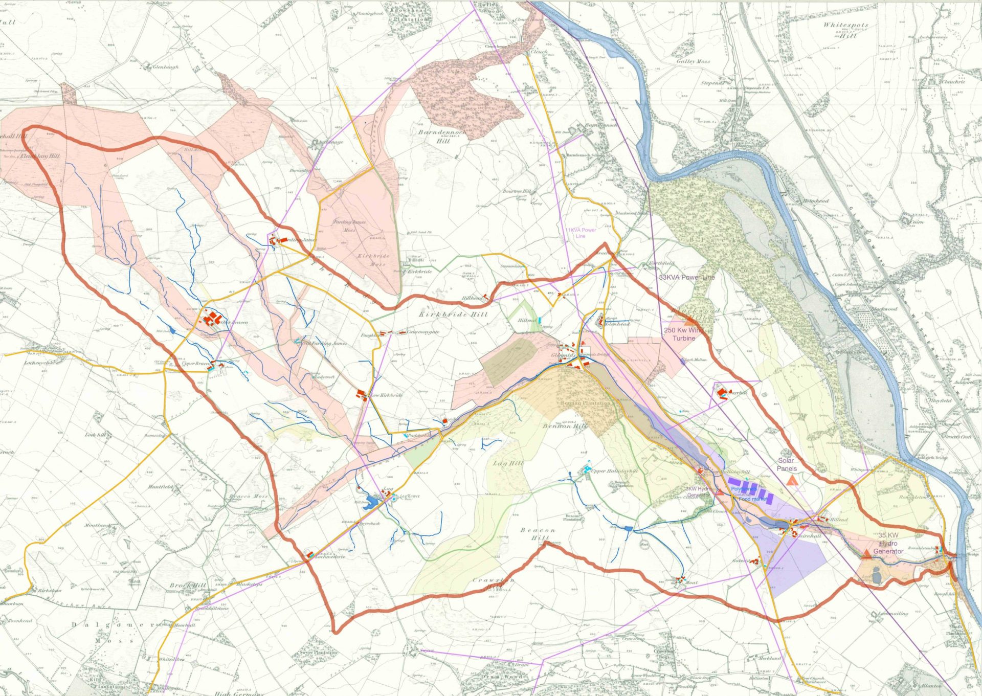
Map 9.
8 + Power Generation. (Orange triangles)
Speculation 3.
Hydro.
Glenmidge burn could support two Hydro schemes.
1. Below Hillend. 35 KW
2. Wet Cleuch, Barndarroch. 3KW
Wind.
250KW. turbine on Blackwood Hill.
Solar.
Panels on the Southern slope of Blackwood Hill, yet to be specified.
At present the grid is saturated at the consumer end, 11KVA, due to a recent increase in the number of small scale, private generating schemes, especially hydro, and although there is not one currently in the catchment there are several in the area to the North where the hills provide the necessary head of water.
There is discussion about reconfiguring power distribution into a cellular network to accommodate more localised generation and transference. Energy policy is moving towards the phasing out of oil as a source of domestic heating and vehicle fuel which will place a greater burden on the grid power supply.
Renewable generation in the form of wind farms, environmentally much better than their fossil fuel or nuclear predecessors, are still mostly owned and controlled by distant and large scale generators whose priorities are not necessarily aligned with local or even national interests. As generating technology develops, a reconsidering of the existing top-down distribution pattern is needed. A cellular network where each cell generates enough to be self-sufficient, and allows some export to neighbouring cells to balance up anomalies, would work very well in rural and sparsely populated areas where there is suitable water for hydro and/or available land for wind generators.
Reconsidering the ownership of power generation is also needed. In Southern Scotland, Scottish power, a wholly owned subsidiary of Iberdrola, a Spanish utilities company, is the main generator and distributor of power. It also supplies an area of North Wales and Cheshire of much denser population. It seems pointless to complain that profits go abroad when Scottish investors also benefit from foreign investment, however the benefits of community owned power can be seen from the few schemes already operating. (Penpont Community Hydro.)
An area of solar panels is included in the Glenmidge scheme along with a battery buffer at the solar panel site.
Realistically, generating cells would not necessarily follow water catchments although it is interesting to consider whether hydro schemes can supply the area of their catchment. There may be a formula for this based on land area, rainfall, overall elevation etc.

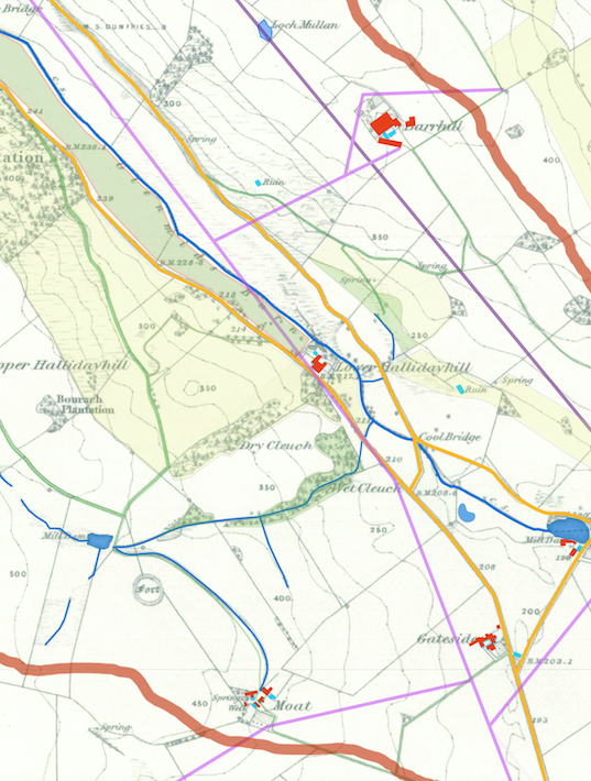
Map of Glenmidge Burn Catchment
- To view the maps in greater detail, please download each map to view using the links below.
- Glenmidge Burn Map 1: 1843 OS Map
- Glenmidge Burn Map 2: Catchment and Water
- Glenmidge Burn Map 3: Roads, Footpaths and Mills, Habitation in 1843
- Glenmidge Burn Map 4: Habitation in 2020, and Woodlands
- Glenmidge Burn Map 5: Powerlines
- Glenmidge Burn Map 6: Speculative Rewilding
- Glenmidge Burn Map 7: Speculative Horticulture
- Glenmidge Burn Map 8: Proposed Lochs
- Glenmidge Burn Map 9: Proposed Power Generation
- Key
Chapter Two: Walks
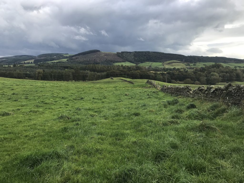
Walk 1. Glenmidge Burn
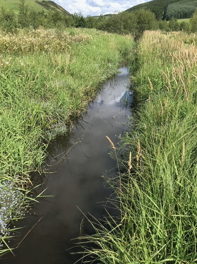
The Glenmidge Burn rises in a series of drying ponds in the depressions among the glacial drumlins WSW of Glenmidge. There is some evidence from an 18thcentury map that this area was known as the Freccars (Dorrit 1750) or Braecocks (Roy 1752) or Brecoch, Breccoes (OS 1955). The name survives in farm names, Braco/Breccoes.
The main continuous waterway of the Glenmidge Burn, from theBreacocks to the Nith is about 6 km. long. From the top of Fleughlarg Hill, the highest point of the catchment a number of small burns gradually coalesce and join the main waterway below the Lag. Many of these have been put underground intermittently to improve the pasture.
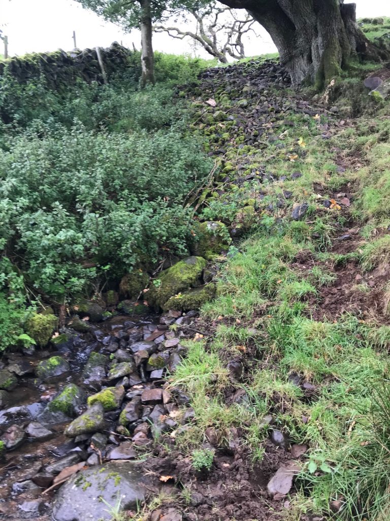
Over its whole length, very little of the Glenmidge Burn and its tributaries have not been subject to training, catchment, or been exploited for their power.
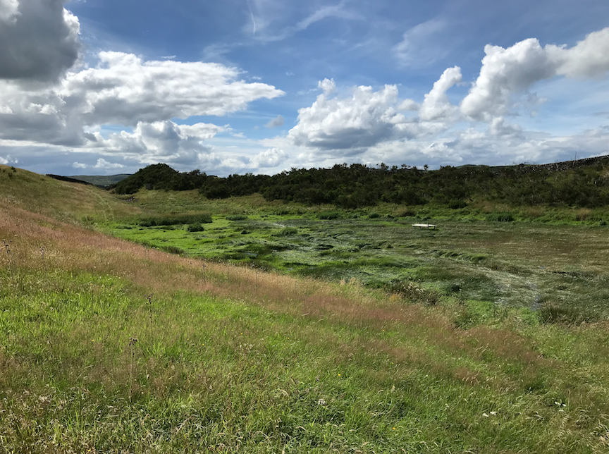
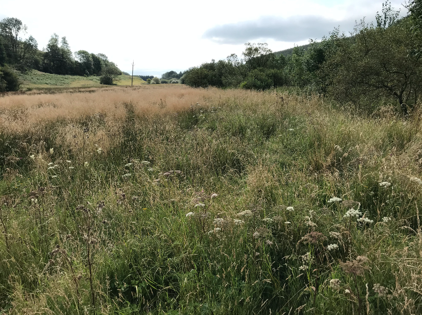
One of the ponds, dryish in this picture taken in the summer, where the Glenmidge Burn rises.
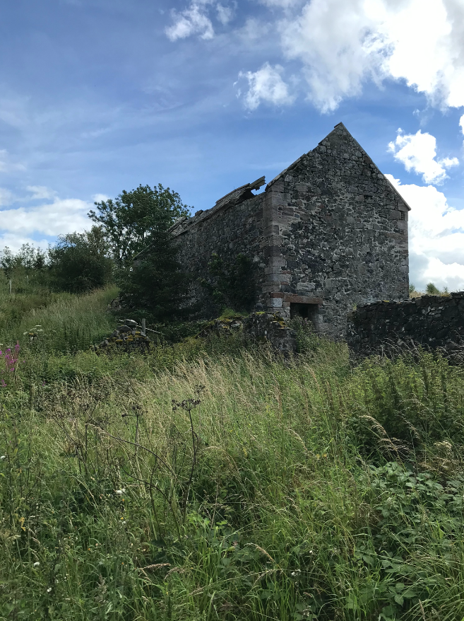
The first Mill is on a tributary draining from Crawston Hill, past Lag Tower, the now ruined seat of the infamous Grierson of Lag, and feeding the millpond next to the road at Lag. It was a grain mill, with an overshot wheel. No date is known for the Lag Mill, it appears first on 1843 OS map but is undoubtedly older than that.
Downstream, after the confluence with the mill run-off, the Glenmidge Burn has been canalised and according to some accounts its bed was paved with sandstone flags, no one is sure why. This is a very boggy area and it may have been done so the burn could be walked to drive fish upstream to be netted. A local account says that even in the 1970s the Glenmidge Burn and its tributaries were teaming with fish. Brown trout up to ¾ pound, a good fish that reminds me of my childhood fishing expeditions.
Below Lag, the burn flows Northeast towards the hamlet of Glenmidge through the newly planted broadleaf/softwood mix woodland in the background of this picture.
The Burn crosses under the road (U384n) at the entry to a steep sided glen close to a now vanished settlement called the BusyBit. On older maps a spring is shown close to this settlement with a short stream running into the Glenmidge Burn but no trace of this remains above ground.
The inhabitants of this settlement of a few households, included a smithy, a cobbler and school until the late 18thcentury when all of them decided to emigrate, with a team of Clydesdales, to Australia. A local newspaper gives the date as 1872 and also claims that there is a part of the old Sydney Harbour called the Busybit. A cattleshed now stands on or near the site.
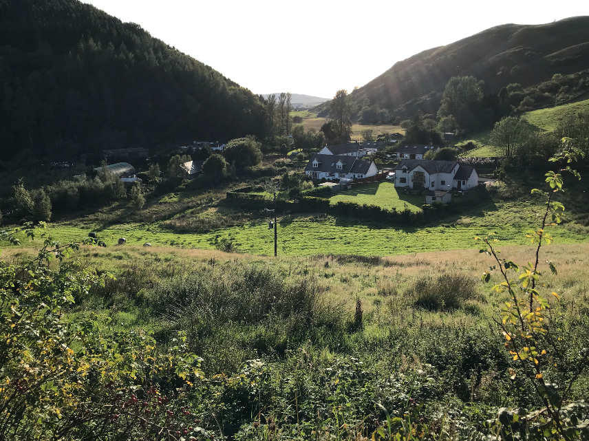
From the Busybit to Glenmidge the burn flows more quickly over a stony bed through the steep sided glacial valley.Glenmidge, originally Glenmids, is a hamlet of some 12 households where the Dunscore, Keir, and Auldgirth roads meet (U377n, U376n) at the confluence with a smaller burn draining from the north.
This picture of the village is taken from the NW looking through the glen towards the Busybit which was on the right at the far end.
After Glenmidge the burn turns 90 degs. to the SE, to the left in the picture, and flows slowly through a wetland for about 1.5k. Local information is that this area was once a small lake.
The burn is obviously canalised from Glenmidge to this point so it is likely that the water course was altered to increase flow to the Allanton Mill pond, half a mile further downstream. From Dardarroch the burn runs uninterrupted through dense undergrowth, past the remains of a retaining wall near the confluence with the Wet Cleuch burn, under the road at Cuil Bridge and on through pastureland to an unnamed settlement (Windsover on some maps) of 7 households at a road junction (C125n, C114n.)
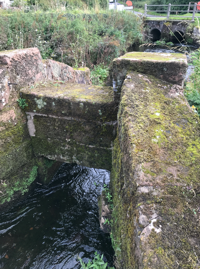
The above picture is of the millpond sluice stone-work and the modern culvert leading to the second mill, Allanton, pictured oposite from the falls below it. It was fed from a very large mill pond, now completely overgrown, via a lade passing under the road to an overshot wheel.
Allanton was a big and commercially run mill.
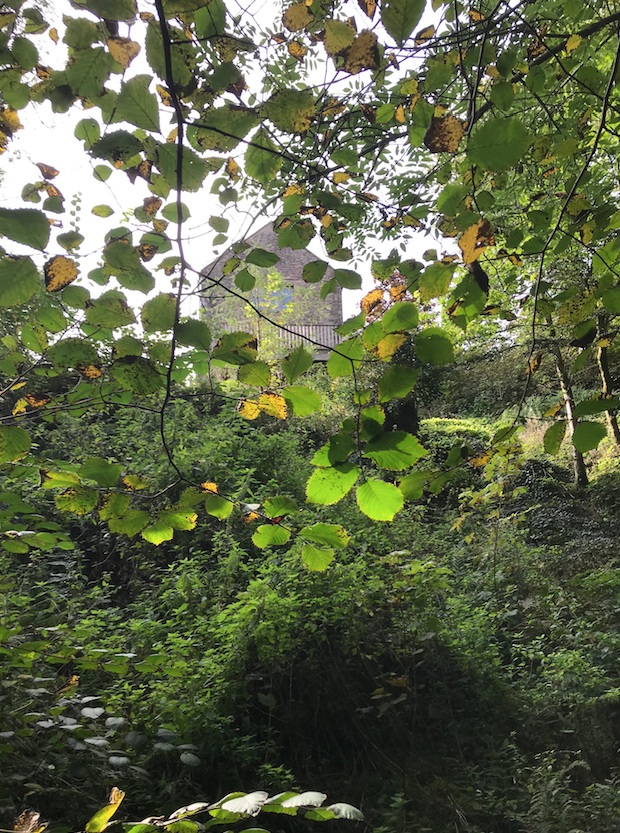
A dated stone shows 1739. This seems quite early though the name ‘Allerton’ appears on a 1750 map. The mill building, is now holiday accommodation.
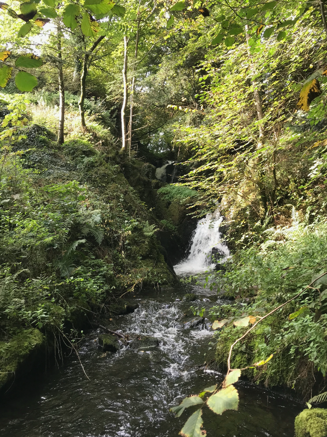
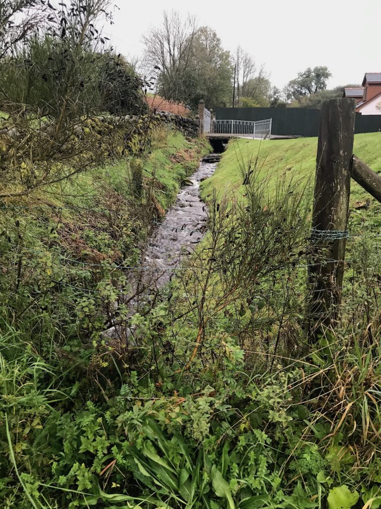
Allanton mill is built on the edge of a very steep gorge into which the burn drops, by a series of falls, 100ft to the lower level in about 300yds. after which it is again trained to run fairly rapidly though woodland, emerging into beautifully secluded meadows before being bridged by the A76 at Burnfoot (Ronaldstone Bridge OS.1843, Rhonestone OS.1888.) and finally flowing modestly into the Nith under a very ancient willow.

Walk 2. Glenhead Burn.
An area of the catchment at the pass between Northfield and Hillhead drains by various field drains into a bog at the junction of the Auldgirth – Penpont Road with the Hillhead roadend. This bog drains south through a narrow field and the burn first emerges from under the Glenmidge Road, tumbling downhill from there towards the village.
In the past the burn would have spread out into the field creating a boggy area where it joined the Glenmidge east of the village. Bearing in mind that the Glenmidge is also canalised it seems likely that the Glenhead burn was, at the same time, trained into a ditch running at the roadside to join the other in a less diffuse way.
Walk 3. An Uphill Fight.
The Wet Cleuch burn descends from an area between the Bennan and Lag hills, South of Glenmidge, and joins the Glenmidge burn on the boundary of a wood near Dardarroch. I decide to follow this burn upstream, as I am not sure where it rises.
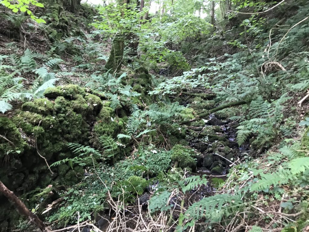
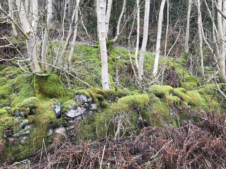
I climb the dyke at the roadside and jump down into a dense growth of brambles, rosebay willow herb, nettles and young willow trees. I can hear water but can’t see it, so I follow the sound uphill, quickly getting soaked, stung, scratched and wondering what this sort of fight has to do with the Atlas Pandemica.
After a few minutes the undergrowth gives way to tree cover and the burn reveals itself as a stony trench, dyked along one side to limit erosion and overhung both sides by unrestrained woodland. This is the definitive Cleuch; dark green, rocky, fallen trees blocking the way and every inch covered in ferns, moss, lichens and succulents. Ash, beech, sycamore and birch saplings stretch towards the light and the earth is black with rotting woodland detritus beneath the leaf litter.
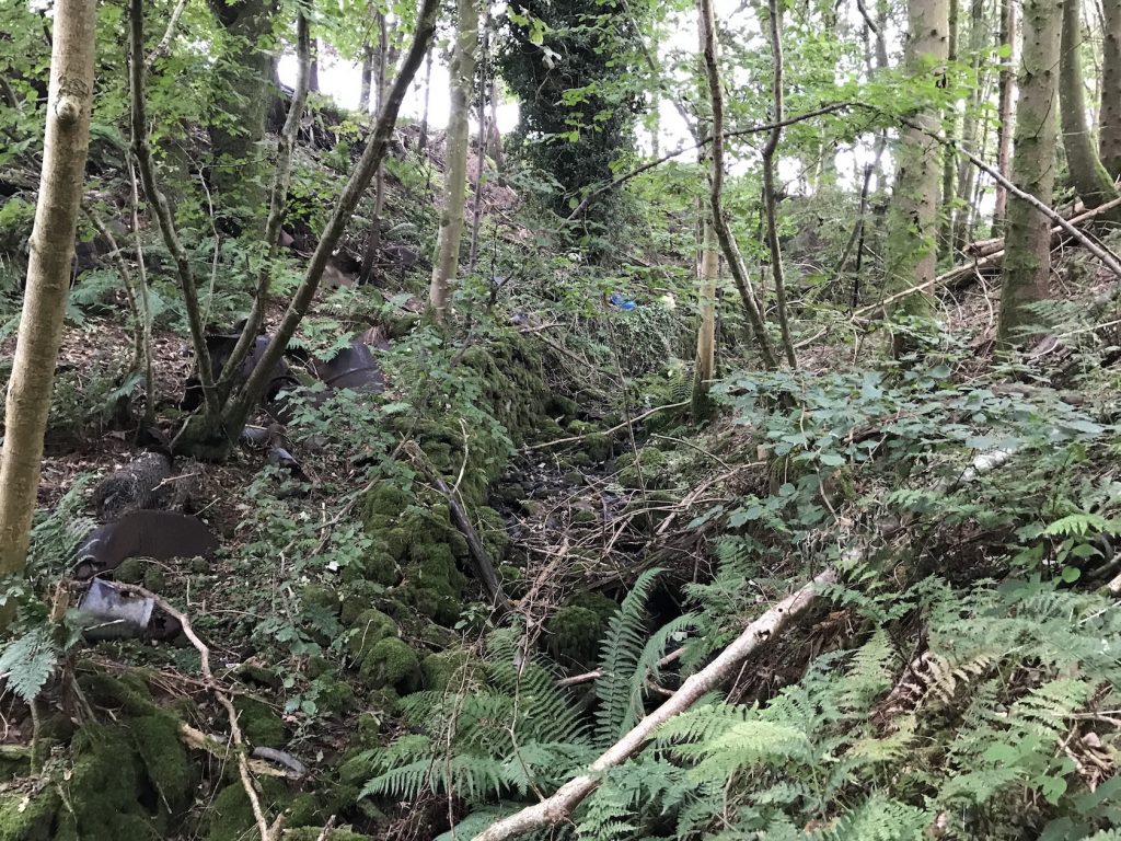
Pathways made by deer and foxes snake over fallen limbs and I try to follow them cursing my stiffness and thinking how slow and lumbering the human animal is. Further up, the cleuch has been used as a coup; rusty oil drums, poultry feeders, corrugated iron sheets and old galvanised buckets emerge from the ground, brown and grey.
This must have stopped being a coup in the 1950s; save for one windblown bottle there’s no plastic, not even white fertilizer sacks that are such a marker of the 1970s. This is a mid 20thcentury coup.
I emerge from the woodland through a fence onto the open hill. There are dykes but many are long down and black cattle seem to be evenly spaced over the grassland. In front of me the burn emerges from under a stony slope with an ancient oak leaning over one side of it. I clamber up listening for the sound of water gurgling below but at the top the burn is still nowhere to be seen. I walk on, still hearing it, to the point where it is swallowed on the other side of a dyke.
The secret life of water. This is a trick it does often for the next mile uphill to its source but first I find the old mill dam I have seen on the map. Now a huge boggy area but once this was the reservoir for the farm mill at Moat, quite a way off to the SE. The mill lade would have followed the contour round the hill for about a half mile to the farm, and then been fed back somehow to the same burn. There is an ancient law, I’m told, that water must be returned to the same burn. I find this all a bit hard to imagine and the exploration of it will be the work of a different walk.
I find the existence of three water mills in the catchment of this modest burn, one of them big enough to advertise its services, an interesting reminder of the significance of water power until the relatively recent advent of electricity. Terms like current, flow, capacity, source can apply to both water and electricity perhaps because of this shared function. However, we must not forget the existence of the steam power, water power in another form, which had been developing slowly for over two hundred years at the time these mills were built, let’s say about 1800 for argument sake. Here’s an extract from Wikipedia:
“By 1800, the firm Boulton & Watt had constructed 496 engines, with 164 driving reciprocating pumps, 24 serving blast furnaces, and 308 powering mill machinery; most of the engines generated from 5 to 10 hp. An estimate of the total power that could be produced by all these engines was about 11,200 hp. This was still only a small fraction of the total power generating capacity in Britain by waterwheels (120,000 hp) and by windmills (15,000 hp); however, water and wind power were seasonably variable.[3] Newcomen and other steam engines generated at the same time about 24,000 hp.”
James Watt was a Glaswegian, Matthew Boulton was from Birmingham, that other great industrial city. Boulton came together with Watt because Watt’s partner at the time owed him money which he could not pay, so he accepted from James Watt a share in his business and patents as payment and the rest, as they say, is history. They became a very successful partnership.
The reliability of water power in the Glenmidge Burn catchment is perhaps not as variable as in some other parts of the country; the burn seems to run even through the driest spells. The ponds of the Breacocks may take the credit for this.
There are instances of steam engines being used to pump water onto water wheels… I digress…
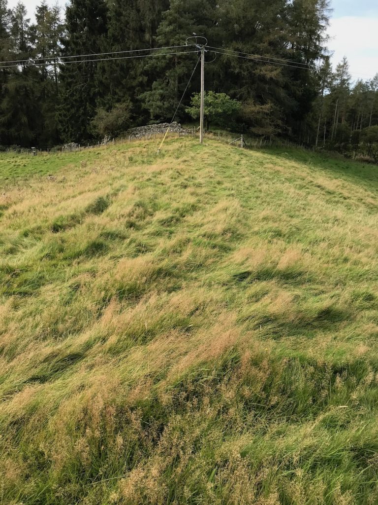
This picture looks down on the area of the old mill dam, the flat and overgrown area in the middle distance is the pond, above it are the earthworks of an iron age hillfort hidden behind which, on its left side, is Moat mill. No visible burn feeds this pond but, standing above it, I can hear it underfoot.
I follow its short visible stretches, fed by several springs, uphill towards the ruin of Upper Hallidayhill Farm, then turn west and find the series of ponds where the burn rises.
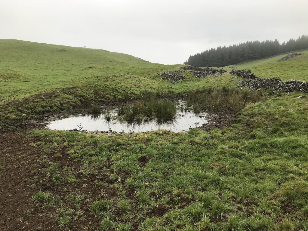
From the ponds, at about 570ft, to its confluence with the Glenmidge burn, at Barndarroch, at 210ft., it falls 360ft. The mill dam, the ponds, the springs and the fall do suggest a possible hydro at the bottom.
I press on over the hill and drop down towards Lag to look at the springs that feed the Lag mill dam.
Lagg Tower on the right, Lag farm in the centre behind the bog and little burn which feeds the Lag Mill dam.
Following the lie of the land uphill, trying to understand the way the water would run off, either into or out of the catchment, in dense conifer woodland, is slow and difficult. The rise levels off, drumlins again characterise much of the topography and make deciding the catchment edge among the trees a hit and miss process. Looking at the track later on Viewranger phone app., my path looks better planned than it felt.
Another digression: Sir Robert Grierson of the Lag is a colourful character, supposed to have been the model for Walter Scott’s Red Gauntlet, and worth researching. He was the Steward of Kirkcudbrightshire, related by marriage to Douglas of Queensberry but is perhaps best remembered locally as Cruel Lag or Auld Lag, scourge of the Covenanters, who is reputed to have rolled his unfortunate victims down the steep side of Lag or possibly Benan Hill, in a barrel with long spikes driven in from the outside. He died in 1733 and is buried in Old Dunscore Kirkyard, perhaps in a coffin with spikes…
His eldest son, William Grierson of Rockhall, as well as being a Tory member of the Commons, was reputed in his day to have been a famous Freetrader, using Rockhall Tower with its view across the Solway as a signal beacon for incoming boats from the Isle of Man. It may have been one of William’s boats that occasioned Burns’ poem, The Deil’s awa wi the Exciseman, apparently written while waiting for reinforcements to investigate a vessel aground in the upper Solway. Freetrading was a very well organised and thriving business in Dumfriesshire in the 18thCentury and regarded more as patriotism than lawbreaking as it avoided paying taxes to the English crown.
‘Smuggling was almost universal in Scotland, for people unaccustomed to imposts and regarding them as an unjust aggression upon their ancient liberties, made no scruple to elude them whenever it was possible to do so.’
Walter Scott.
Chapter Three: Catchment Perimeter
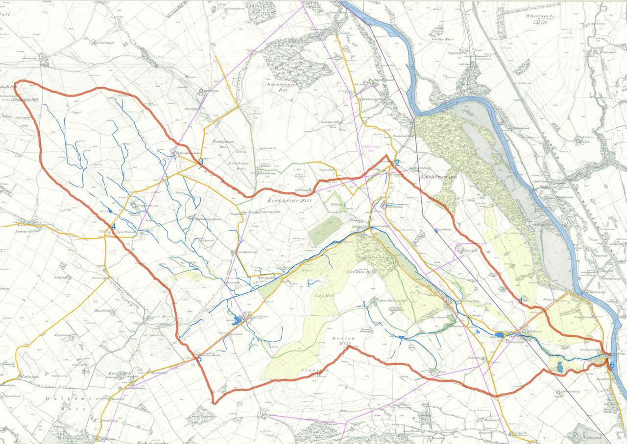
Walk 1. Nith, 6 to Catchment position 1.
Sept 18th. Distance 0.79miles. Elevation, from 85 – 291ft.
The catchment remains very close to the burn’s issue into the Nith, the land is a completely flat flood plain between the Nith and the A76. After crossing the road north of Rhonestone (Ronaldstone)Bridge the catchment edge rises steeply to the north along the edge of the road cutting, but then turns NW along a rising ridge to a softwood plantation.
Following the lie of the land uphill, trying to understand the way the water would run off, either into or out of the catchment, in dense conifer woodland, is slow and difficult. The rise levels off, drumlins again characterise much of the topography and make deciding the catchment edge among the trees a hit and miss process. Looking at the track later on Viewranger phone app., my path looks better planned than it felt.
I cross the Auldgirth – Penpont road into another and even denser plantation but as the ground rises, the drumlins give way to a steep hillside, a scramble through low limbs in the half-dark to emerge at a colourful and poisonous fence.
The next field keeps rising but less steeply to a dike and seeing a bull on the other side of it, I decide to end the track here, at point 1, for today and return through the fields to the road.
Walk 2. Done in reverse from point 2 to point 1.
Sept 19th. distance 1.36 miles, elevation 291 – 596ft
Starting from the high point on the Auldgirth to Keir road where the catchment crosses the road, the rise is quite long and steep through three fields to the plantation on the top of Blackwood hill. The line of the catchment runs briefly and level through the plantation then emerges again to run in a straightish line, gently downhill to the NW of Barrhill to meet the end point of this walk at point 1. I see the bull again but he seems a little tired today and is not interested in me.
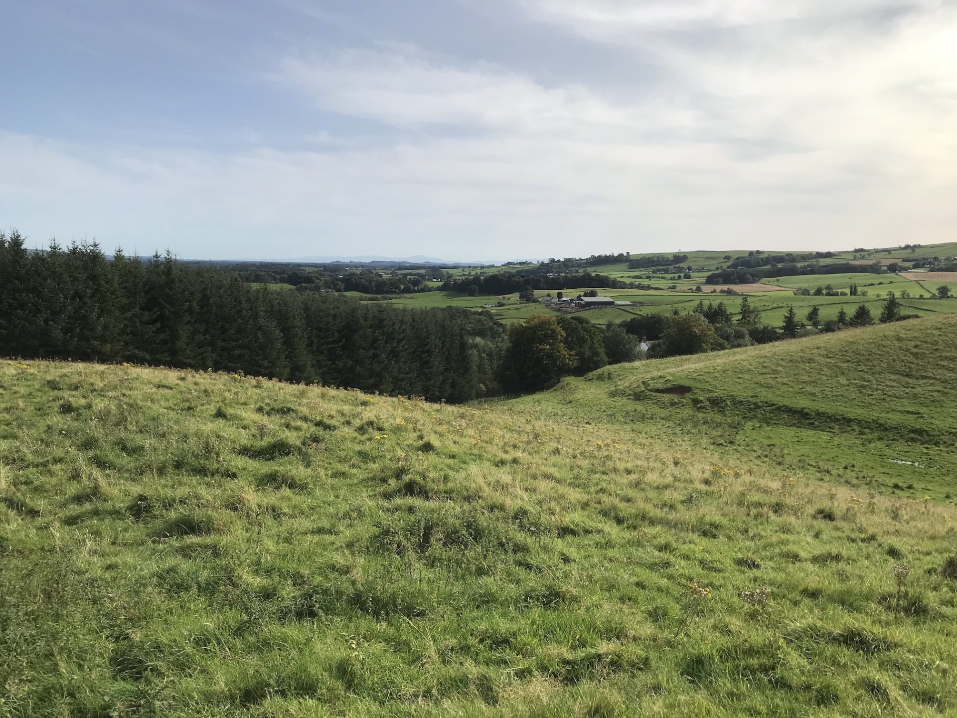
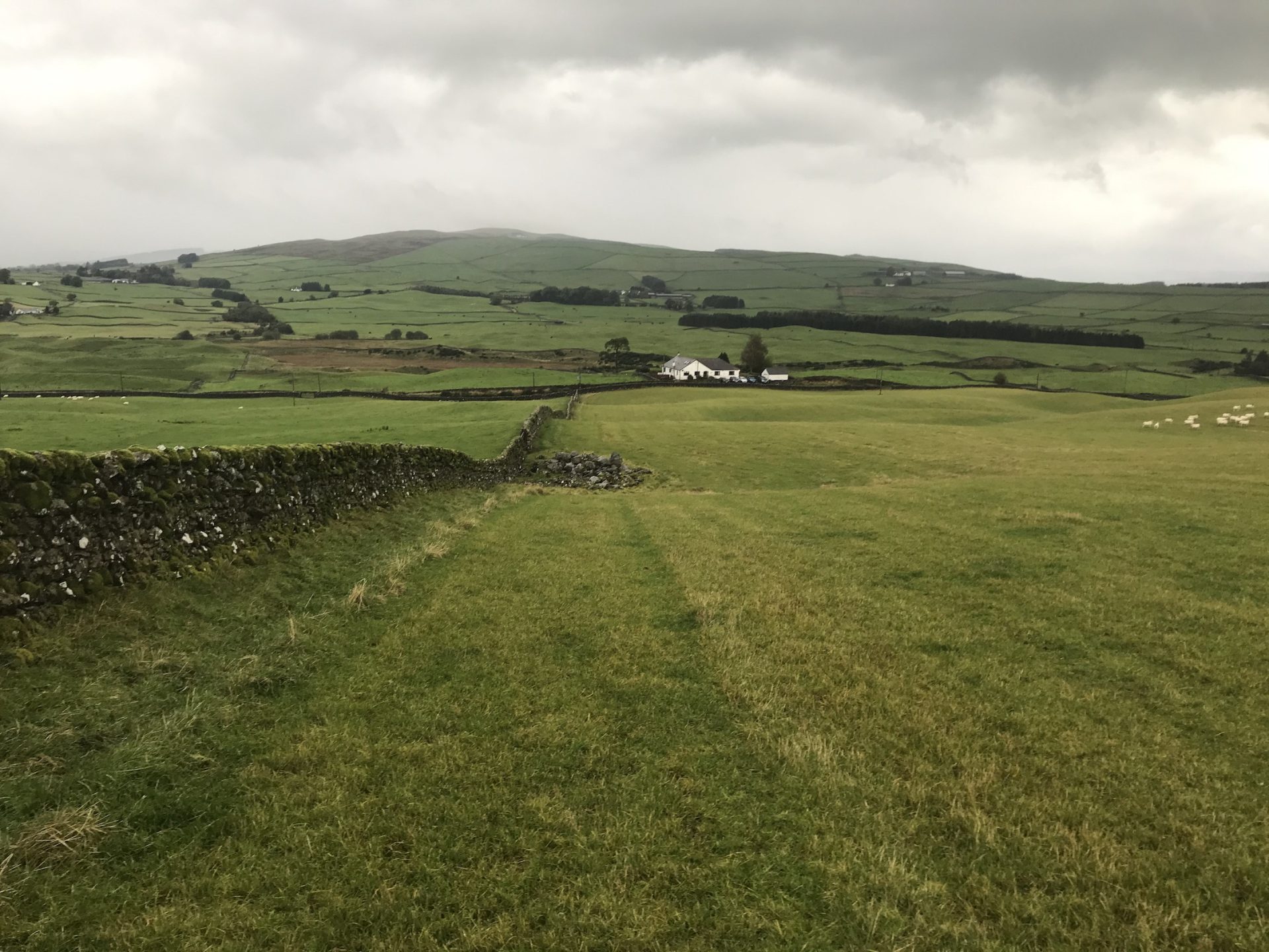
Descent off Blackwood hill with the track of an old road and a spring, on the extreme right of the picture above. Hillend in the trees and beyond, Lochmailing, which is the southern extremity of the catchment. On a subsequent walk today, January 17th., I met a neighbour who told me this track, 30 years ago when he was a young man, was driveable in a car. It runs from Hillend to Barrhill and certainly would not be driveable in a car today though it is still clearly visible and easily walkable. It is marked on my maps as a path.
Walk 3. Position 2-3.
25th September. 2.42 miles. Elevation start 324 ft., max elevation 631ft., end 480ft.
The first high point is very close to the road, a hillock in a silage field from which I took this picture, looking SW., at the direction of the next section of the catchment perimeter to the top of Kirkbride Hill, a climb from 324 to 649ft of some 325ft.
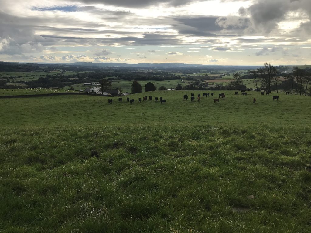
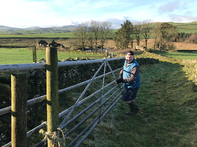
The way is easy, level at first but steepening towards the top. I detour along the farm track to Hillhead farm to avoid cows with calves and to get permission of the farmer to cross the land. This is a sensitive area about which I have been a little insensitive. In theory one can walk anywhere but as I live in the catchment and would like to engage my neighbours in the project, asking permission is obviously preferable. I am ashamed to say that at the very outset I did not follow my own advice and met a neighbour for the first time blithely wandering through his field. I can only hope my subsequent apologies and explanations have redeemed me.
Explaining what I understand about the Atlas Pandemica is slightly comical and perhaps more use to me than anyone else. Having to explain something is a good way of having to make sense of it. So, what do I say? I say I am looking at the possible changes Covid19 will have on our lives and consequently, on the condition of the place we inhabit. I say that it’s an interesting definition of a community, the way water drains off the land. It works on a larger scale: Nithsdale, Annandale etc. And I say that I am working on the idea that if we all spend more time in this place, because we cannot travel, our lives in it, our feeling for it, and our understanding of it will change. I am interested in what those changes might be. I also say that Covid will change us, but not as much as climate change will and so, by looking at Covid, it may be possible to anticipate the bigger changes to come. It makes a sort of sense to me but…
The word landscape comes up a lot.
The top of Kirkbride Hill gives a pretty comprehensive view of the western part of the catchment and the shape of the area becomes clearer. In this picture, looking south to the ponds formed in the depressions between drumlins, the beginning of the Glenmidge Burn can be seen on the low ground. It is arguable which way the furthest of these ponds drains, and there are others beyond the sightline which definitely drain towards the Birkshaw Burn and the river Cairn.
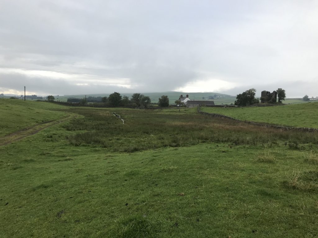
The descent towards Kirkbride Farm, (Faughland OS.1843), is fairly steep through fields as far as the Kirkbride track but then levels and the catchment perimeter rises again along The Ridge towards Fardingjames. I ended this walk at the road near the Fardingjames entrance then walked back along the road to Kirkbride to meet and speak to the owners. Kirkbride, Fardingjames and Moat Farm, on the southern edge of the catchment are all owned by the same family.
Walk 4. Points 3-4. Fardingjames, Fleuchlarg Hill, Braco.
1st October. 2.72 miles. Start 480ft. – summit 925ft. – end 382ft.
In this photo, taken near the beginning of the walk, the view is SE over Fardingjames, back along the Ridge, the rounded fields above the large shed, to Kirkbride on the hillside. The hilltop on the left is Kirkbride Hill. Lag is in the distance to the right, a white gable just below the right hand end of the dark plantation, and the glen leading to Swyre is just to the right of it with a sunlit patch behind it. The southern edge of the catchment crosses that glen more or less along the visible line of the hill with the sunlight behind, then rises over the wooded hills to the left, running east to the Nith.
This walk, which started very promisingly with a chance encounter and an amusing conversation with the owner of the land, became the hardest so far.
The climb to Hill Moss is moderate, the biggest obstacles being dikes and electric fences which are hazardous. Hill Moss is a level hilltop, aptly named, and crossed by deep drainage gulleys. Thence the walk to the Fleuchlarg/Wallacehall Hill is gentler but crossed by a large electrified march dyke which takes some care to negotiate. On this occasion I avoid electrocution.
The descent towards Braco is steep, the ground is rough and I am no longer sure whose land I am on; several farms share slices of this hill and the big march dykes seemed to me to radiate from the top and run straight down towards the lower ground. Looking at the map now, I cannot see this pattern. The catchment comprises approximately a 30 degree slice of the hill facing SW but my actual track, based on the lie of the land, seems to defy this logic and crosses back and fore over the dykes which is exhausting. The lower I get towards the drumlins the fall lessens and the harder it is to discern the catchment edge.
While making my way to the road at point 4, I reflect that although the view over a hilltop may be breath-taking, I have never been a great hillwalker. I have been up the odd Monroe, up a couple of big ones in the Lake district, but given the chance to follow a burn, follow its overgrown and secret course cut steep into the land, that’s what I would choose every time. As a farm boy in my native Wales, that’s where you’d find me; up to my knees in the water.
Walk 5. Lochmederie to the Nith.
4th October. 3.2 miles, elevation: 269 – 688 – 90ft.
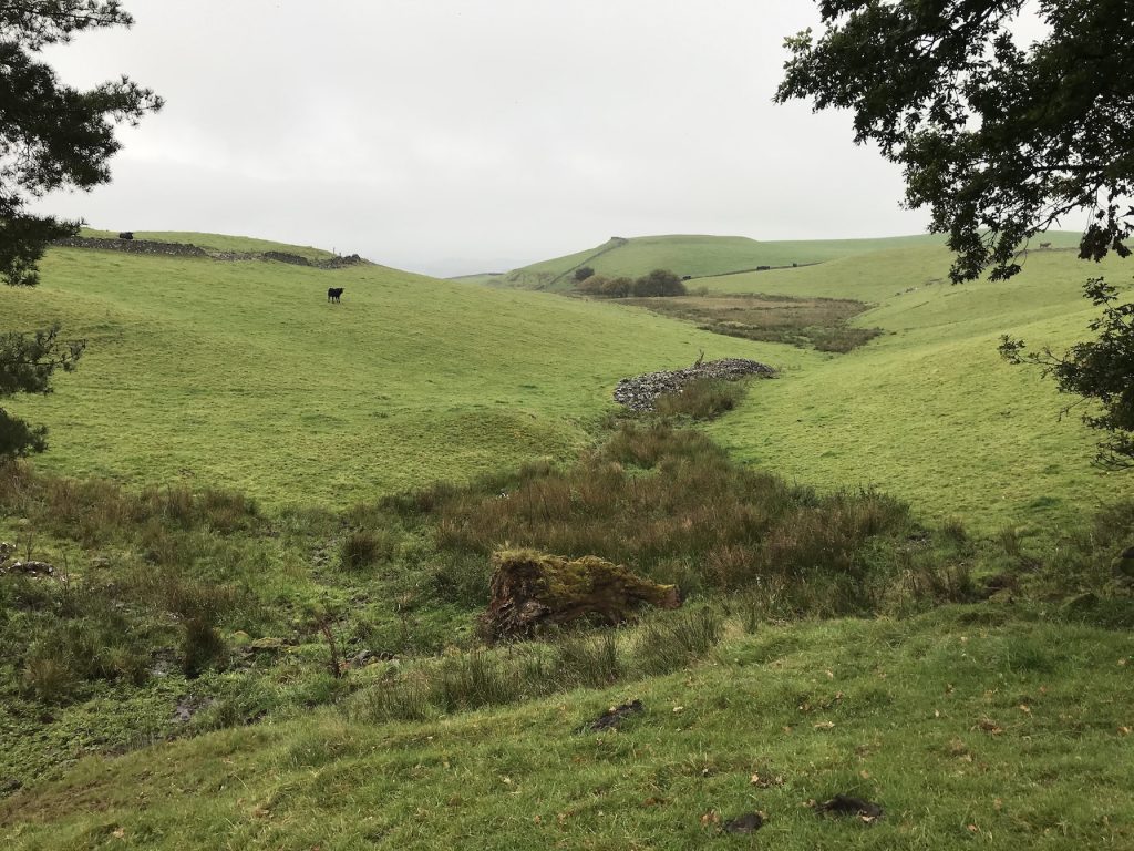
Starting on the Glenmidge – Dunscore road at the high point at Lochmederie house it’s a fairly straight ascent to the south to an unnamed high point on the ridge between the Glenmidge and the Laggan catchments.
This picture looks back over my track to the Northwest over Lochmederie, point 5, over the Breccoes with Fleuchlarg Hill in the background with its head just in the cloud. The catchment edge approximates to this site line.
This unnamed hill is the southwestern corner of the catchment and at the top I turn East over a similar hilltop before dropping down over the Swyre track and start the long climb up to Crawston.
I bisect the triangular field in this picture with a very steep climb to the corner covered by the power line pole. The going is easier after that to the summit, at 700ft.
In this bad photo taken from Crawston, the next high point, Beacon Hill to the NE., is just visible in the centre of the picture as a nipple on the ridge, but it gives a good sense of the scale of the country. The catchment of the Glenmidge, my focus here, is perhaps typical of the gentle lowland hills of lower Nithsdale; short burns, sometimes high energy, but generally draining basins through short glens in quite intensively farmed country.
To the South, Laggan Glen is very similar with several farms, like the Swyre where I am now, dropping down into both glens. A few miles further up Nithsdale, top left of this picture, the Scaur, the Shinnel, Marrburn, Cample and the Carron are all bigger, all called ‘waters’ and descend through long glens from much higher ground.
This is the view from Beacon back to Crawston. Glenmidge catchment falls to the right.

This picture is the view from Beacon Hill, looking East towards the Nith. Dumfries is to the right of the frame. The direction I take is over the high point to the right of the hillfort then down towards the farm buildings just visible beyond the hill on the extreme right of the frame.
View from halfway down at Moat Farm (also the name of my childhood home in Wales) named after the hillfort in the previous shot. In the upper left, in front of Lochmailing Farm buildings, is an oval, flat-topped mound with a dike running across it. That’s my next waypoint though the edge of the catchment veers a little to the right on the way.
Last useable shot, taken just after the mound looking along the catchment, more or less following the dyke, to the edge of the woodland that marks the last drop down to the Nith.
View from halfway down at Moat Farm (also the name of my childhood home in Wales) named after the hillfort in the previous shot. In the upper left, in front of Lochmailing Farm buildings, is an oval, flat-topped mound with a dike running across it. That’s my next waypoint though the edge of the catchment veers a little to the right on the way.
Some time later, 18 Nov 2020. Recapitulation to date.
Completion of the walks along the Glenmidge Burn and subsequently of the catchment watershed was the first milestone of the Landwatership expedition. It gave me a sense of the land itself beneath the surface, its structure, its geology, its character and size. As part of this process I met the people whose land I wished to cross to discover the likely hazards; bulls mostly at that time of year. Barbed wire turned out to be more injurious especially to my clothes though bulls remain more frightening. My fear of barbed wire is insufficient, I decided, as I courageously crossed the many fences, tearing my clothes and fingers whereas my fear of bulls, visceral, thankfully remains unproven. Only one displayed any interest in me and, luckily, I did not have to cross his field. Others were dozing or preoccupied with their harems but the fact remains, it’s the small stuff that hurts you, the big stuff can kill you.
Mention of my Welsh origins and talk of bulls and fences reminds me of Charlie, our Hereford bull in the late 1960s. Charlie was a very good natured 1.25 ton beast who allowed his face to be stroked, his huge pink eyes with long white lashes seemed all benign. But Charlie was a very quiet nuisance; he was old fashioned, he had an ancient instinct that reached back to the open grasslands and sheltering wooded glades which did not include fences, hedges, fields and land ownership. Once he had made the rounds of the heifers, he would wander, and they would follow him, regardless of what for Charlie were trifling restraints. He would push his way through any fence or gate to a piece of woodland where he would lie down with his harem in the shade and chew the cud. He was a charmer, Charlie, with a sense of what he liked; heifers and trees.
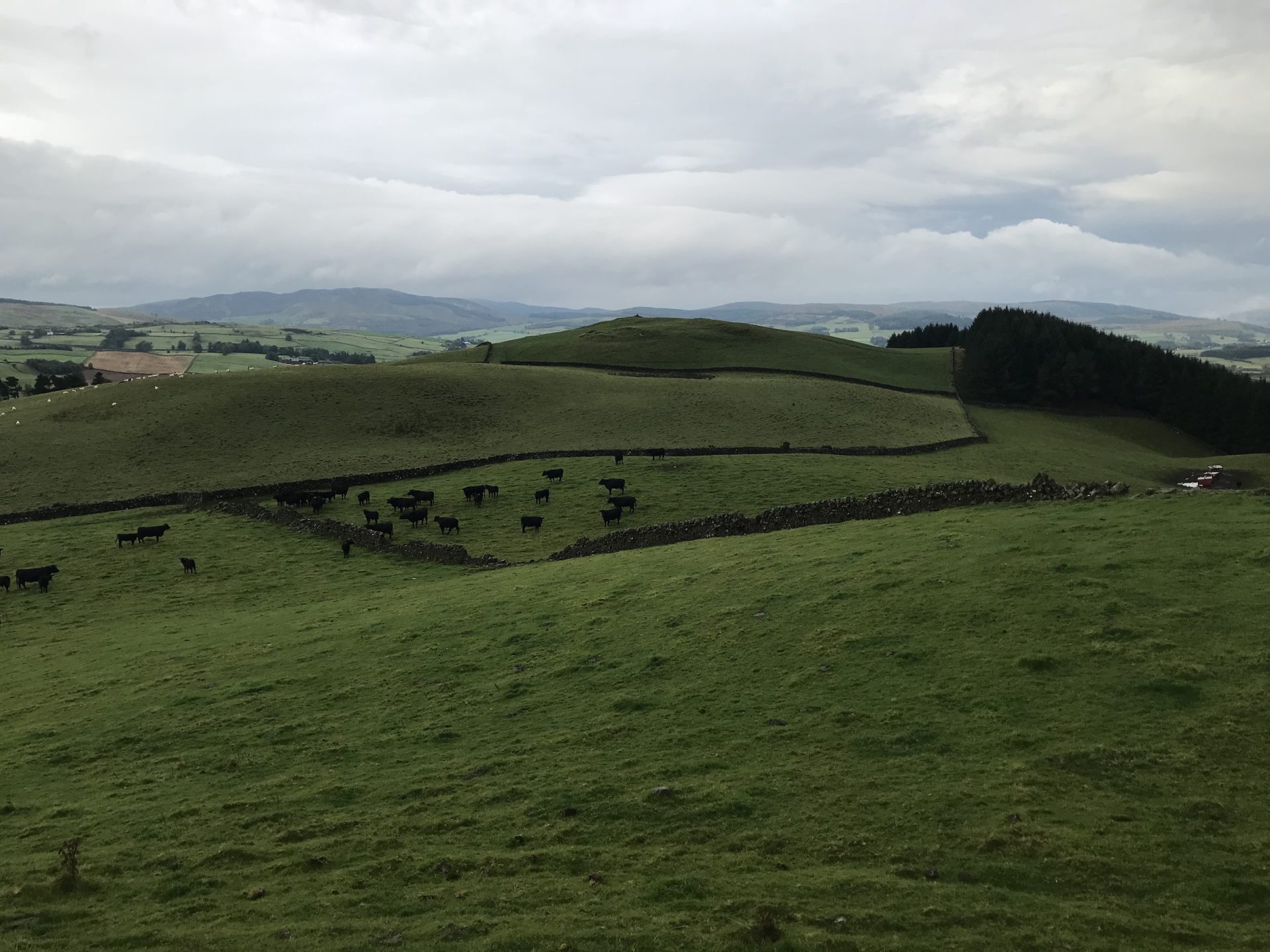
Young bullocks, on the other hand, are alarming. They race towards me and skid to a stop, then, as if by telepathic consent they turn and bolt away again anticipating exactly my heading so as to extract all the possible fun and panic out of this strange upright and lightweight figure, me, that needs to maintain a direction and ignore the convenience of gates. Here’s a herd of young stock about to get the most out of my presence.
Over the period of the project, in a haphazard sort of way, I have met members of 39 of the 45 households situated either in the catchment or which own farmland in the catchment and have spoken to them about the project. There are currently two empty houses, and two which have been sold during the period and the occupants are moving.
23 of the households including my own I already knew, 22 are new to me.
How have people responded? Generally people have expressed interest in the project but, although everyone I have met has been given an information sheet with my email address the uptake has been fairly modest, less than 50%.
In almost all cases people have expressed an interest and have been at least patient with my explanations. Some 5 households have become engaged in the project and have fed in a lot of information.
I have excluded deliberately from any part of the project, any consideration of the ownership of land. With a completely hypothetical approach such as this I have let the catchment itself suggest what might work and where it might work. The very good example of this is the potential for a hydro generator below Hillhead. Including the millpond which would be the beginning of the feed pipe, the run of the burn as far as the generator position, grid connection etc., there may be as many as four landowners. This means that perhaps the only way this could work, certainly the most straight forward would be some level of communal ownership. I imagine that whole community ownership without disturbing the actual land ownership might be a possibility.
I look out of my kitchen window at Blackwood Hill and instead of white sheep on a green ground edged by grey dykes, blackthorn and a line of conifers under a lowering sky, I begin to see the palimpsest of my proposal; a progressive re-conception of landscape (that tricky word) informed by something that seems to me now to have been simply greed.
There is no reproach in this statement, no one is more or less at fault, we are all taking from the land. We are a farming culture because in the end, food security is what allows us to be bankers, lawyers, artists and such. Despite all high-tech promises, there is no significant synthesised food, it all comes out of the ground. As I review and edit what I wrote back in the Autumn about my walks through, and round the edge of, the catchment, and about the layers that make up our understanding, I find it impossible to be unaffected by the world as it is at this moment.
“Atlas Pandemica:Maps to a Kinder World is a project that is designed to encourage innovative approaches in charting the changes that have happened around us recently and to try and navigate the way forward into a more hopeful and shared future.” was a challenge taken up by a disparate group made up of artists, a dancer, an academic, a writer, a poet, a songwriter to look at the tea leaves in the cup of the present, and understand where they may point.
It was during a time when the first wave of Covid seemed to be passing, the sun was shining and, though people were having a very hard time, it felt far away. The walks following the Glenmidge burn, conversations with my neighbours, especially the ones I had not met before, were for the most part easy and, although I had no idea where this project was leading, everything seemed somehow sunny and positive. It was a very beautiful summer.
The clouds on the horizon were gathering though and with the onset of Autumn, the American elections, the resurgence of the pandemic and the absurd panic over Brexit came sliding across the sky. It felt like a very cold front indeed.
After the storming of the Washington Capitol, Trump’s last stand, which seems to rank alongside Custer’s and Davie Crockett’s in its misguided understanding of the odds, let alone the morality of the cause, I read that some of the survivors are asking for a presidential pardon. The word, survivors, here sets this last stand apart although it is applicable as there were deaths. In contrast, Little Bighorn left no survivors on the losing side, the Alamo only a few. I am struck by the story of a Texan ‘realtor,’ who took a private jet to Washington, tweeting all the while that she was responding to Trump’s call and this was, ‘life or death.’ And, on the very steps of the Capitol, she took the time to tweet a mini advertisement for, ‘your favourite realtor.’ Then, having been arrested and facing a jail sentence for insurrection, or whatever the charge may be, she is seeking a presidential pardon, as though this was some episode in a soap opera. “I have been wronged.” she says, “I am a patriot.” Maybe America really is a soap opera.

Speaking of survivors and unlikely fictions; on the same day at the other extreme, Alexei Navalny flew home to Moscow straight into the welcoming embrace of the FSB security services. This Russian opposition figure, patriot you could say, is a survivor of Putin’s Vermin Control Scheme which isn’t going terribly well. After months recovering from the attentions of Poisonous Dwarf, Navalny is ready for round two, brave man, protected perhaps by the world-wide news coverage. I don’t think you can become immune to Novichok, or Vladimir Putin for that matter and there is no pardon on offer here.

When I was a kid, Mad Magazine had a comic strip called, Spy vs. Spy,in which two identical figures, one black, one white, tried by various incompetent schemes to do each other in. As the FSB handbook, Mad Magazine is finally enjoying the serious attention it always deserved. Navalny was shadowed by Vlad’s rodents, with daggers drawn and bomb fuses fizzing, back and forth across Russia to at least 40 political engagements before they managed to get him. The possibility that it was his underpants that carried the nerve agent even surpasses Mad’s wildest ideas.
These are easy targets, of course. More difficult is trying to understand either reality and, in the Russian example, accepting that these atrocities are the visible tip of an enormous iceberg, and what’s it got to do with Atlas Pandemica…
As I retrace my thoughts along the ridges outlining the Glenmidge catchment I wonder if the Texan realtor’s expectations are just plain hypocrisy or if a feature of 21st. century life in these privileged parts of the world isn’t a sort of distancing, a feeling of insulation, from the consequences of our self-indulgence. I look at animals grazing a Scottish hillside, cattle and sheep, and the monoculture they live on. European animal feed is often made using soya that comes from Brazilian land cleared of rainforest. EU agricultural subsidies have encouraged the intensive farming of every square inch of land, at the expense of species diversity, to produce food so cheaply that we can afford to throw away 30% of it. So, I am asking myself; what makes me any different from the realtor? And, do I expect to get away with it?
Chapter Four: Palimpsestic View
The picture above looks WSW from Blackwood Hill near Barrhill Farm. The flat-topped hill on the left of the middle ground with a dyke running up over it is an iron-age hillfort, (c.1000 BC.) The horizontal scar along the face of this hill is the track of the mill-lade to Moat Farm, (19th.C.) The field layout and dyking (18thC.) The power line coming up hill is the supply to a mobile phone mast, (21st.C.), and the other higher line is the (20th.C.) 33KVA line running over Blackwood Hill.
The topography is formed by glaciation, frozen water pressing down and grinding over the land, in the Devensian period, 33,000 – 12,000 years ago, echoes the landwatership proposition that their conditions are interdependent. In this picture the hills are again covered in a layer of ice.
Footpaths
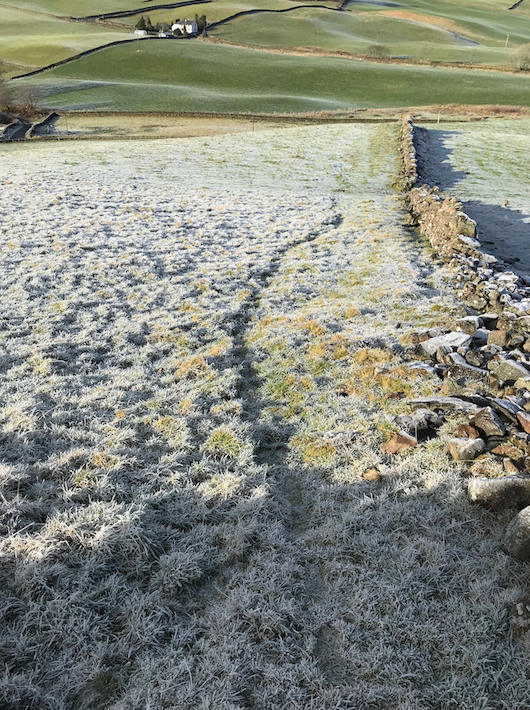
On the left is a picture of a process. This route, regularly taken over the years but much more frequently during lockdown, has recently become a visible pathway towards an opening in the dike in which I am standing to take this shot. It is made more visible by the low angle of the sunlight as are my footprints.
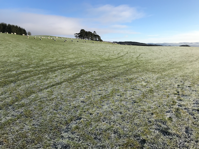
On the right is a similar process made by sheep spreading out across a field away from a gate behind me to the left.
Walking has become a much more popular activity during the Covid19 pandemic and lockdowns. On a single day, one catchment resident reported counting 22 walkers passing in front of his house. We are fortunate in Scotland to have the right to walk across other people’s land and, generally, consideration for the concerns of landowners are understood and respected. In a series of chance meetings while out walking and conversations with catchment inhabitants regarding good walks, I discovered that a neighbour had been working on reinstating footpaths through the area because he has an interest in hill running and organises several annual running events in the catchment. This conversation began to include other neighbours, and a farmer across whose land a particularly interesting pathway passes. In detail of the catchment map below, the ends of the interesting path mentioned above are marked with the word Footpath, and the path itself is shown in green.
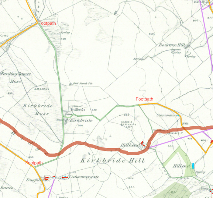
This pathway was originally a continuation of the Stanumlane Road to Kirkbride and the site of the unfortunately named, Killbride, then either right towards Auchenage and Kier, or left to the road near the modern Kirkbride Farm (Faughland, 1843
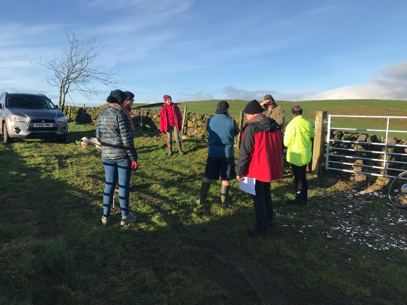
This picture shows a meeting of the Keir Penpont and Tynron (KPT) Development Trust, Connecting Communities sub-group and some catchment residents who have come to walk the pathway.
This picture shows the point where the path/road becomes confined between dykes which continue as far as Kirkbride, in the background of the picture below.
Hill-runner, catchment resident, and footpath advocate guides the group towards Kirkbride.
The old road toward Auchenage from Kirkbride.
News came through today, 3rd February 2021, that the local authority have looked at this and are going to support the costs of fencing the path.
Chapter Five
Just as the Atlas Pandemica project is nearing its conclusion new information starts to emerge which again shifts my perspective of the catchment.First, in the last 30 years rainfall in this area has increased by some 25% (tbc).
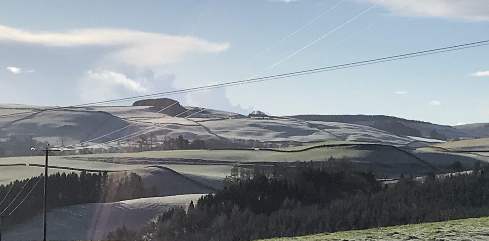
The noticeable increase in moss maybe a result of higher rainfall. This is the Northern side of Halliday Hill which gets no sun between November and February so it was always quite mossy.
Second, an enquiry I made at the beginning of the project, 9 months ago, and then forgot; the possibility of re-introducing beavers to the burn has re-surfaced first in a news article in the Guardian about the success of beavers reintroduced on Exmoor, and then in a message from Bamff estate, Perthshire, where beavers have been living for some years. Maybe when we are released from Covid restrictions, someone may visit from Bamff to look at the feasibility of this idea. More about this project available here
Rainfall increase. I found myself wondering about the 5.9 million tons of water that drains into the Nith every year. Rivers are dynamic systems and a 25% increase in rainfall must have an effect, not least in the amount of material the river will carry with it; sediment, organic and mineral. Erosion, the most obvious aspect, is accompanied by another less obvious, of deposition. In spate a river may carry smaller material over its whole length in one go but under milder conditions, eroded material may be deposited only a little way downstream. The river becomes a mixing area bringing materials and nutrients as much as taking them away. A riverbed is an environment in constant flux, pardon the pun, sometimes slow and gradual but at other times, extreme, possibly changing its course altogether. High energy rivers often have a braided character where a number of alternative channels can become the main one depending on the violence of the last spate.
Except for the falls below Allanton Mill, Glenmidge burn is generally a low energy waterway and therefore easily canalised over almost its whole length. It runs fairly constantly in dry weather.
Water Quality

BIOLOGICAL WATER QUALITY SURVEY OF GLENMIDGE BURN – 12/11/20
A survey was undertaken as part of the Atlas Pandemica Project on the Glenmidge Burn using an assessment based on the use of river invertebrates.
Method
The methodology uses established criteria employed by UK water regulators and scientific bodies developed by the British Monitoring Working Party to produce a score (BMWP score) based on the sensitivity of river invertebrates to pollution. Clean unpolluted watercourses are diverse with a higher range of invertebrate types including more sensitive types. Polluted waters show a limited variety of invertebrates of greater pollution tolerance.
The method assigns a score for each invertebrate type (taxon) found in UK waters relative to sensitivity ranging from 10 for the most sensitive to 1 for the least sensitive. The sample is taken by disturbing the river bed substrate with a foot for a measured time e.g. three minutes, capturing the dislodged invertebrates in a net and washing the contents into a wide white tray. The sample is sorted through in situ and invertebrates are identified. The score for each type of invertebrate is noted and a score for the sample totalled as well as the approximate abundance of each type. An average score per taxon (ASPT) is achieved by dividing the total score by the number of taxa. Scores of over BMWP 100 and ASPT of greater than 6 indicate very good water quality with little or no pollution. A score of BMWP 10 or less and ASPT of 3 would indicate heavily polluted conditions.
The advantage of using this method of assessment is that the river invertebrates (stonefly, caddisfly, mayfly larvae, snails, beetles, crustaceans etc. that live in the waterbody are subject to everything that is carried by the waterflow and the effects of any pollution that occurs either as a one-off incident, intermittently or frequently will be reflected in the range, number and type of species present. This has a particular advantage over a water sample taken at a particular moment in time that is analysed for chemical components in that pollution may have occurred sometime before the sample was taken and no longer be present in the water, whereas any impact on river invertebrates will be detectable by analysing the composition of the invertebrate population.
It is possible to detect a recent pollution event by observing the remains of dead invertebrates or the remnants of fine-particled sand or vegetation cases left behind after the occupants died (caddisflies) or empty shells (snails, limpets etc.). It is also possible to determine whether the water course is frequently or constantly polluted by the type of invertebrate that live there as pollution tolerant and pollution sensitive types have been previously identified by the BMWP method.
Two sites were chosen – just downstream of the village of Glenmidge and further upstream just below the Busy Bit Bridge downstream of Lag Tower.
You can read the resulting data sheets identifying species types recorded as part of the water quality test by downloading the accompany pdf available here: https://thestove.org/landwatership-data-sheets/
Results
Site 1 D/S Glenmidge
Remarkably diverse and abundant invertebrate fauna. Some unusual caddis taxa and high number of different types. Large number of flatworms (Planariidae) and water shrimp (Gammaridae). Very good water quality with no sign of pollution.
BMWP 101
No. taxa 16
ASPT 6.31
Site 2 D/S Busy Bit Bridge
Much lower diversity of taxa. Higher number of invertebrates tolerant of poorer water quality. Empty cases of several types of caddis larvae showed that invertebrates requiring clean water conditions (unpolluted and well oxygenated) had recently been present but some pollution event or events had taken place fairly recently (within a few weeks/months) that had killed them either due to toxicity or severe reduction in oxygen levels (e.g. organic pollution).
BMWP 39
No. taxa 9
ASPT 4.33
These results show a surprising difference within the distance of about ¾ of a mile. There are a number of possible reasons. A significant characteristic of the stretch of burn between the survey points is that it flows fairly rapidly over a stony bed oxygenating the water which neutralises the pollutants. Other burns joining between the points are not from intensively farmed land, but from woodland or steep rough land, so the addition of cleaner water will also improve the overall quality. There is also the possibility that a single catastrophic event has occurred. More regular testing would have to be conducted to establish if that were the case. It would also be useful to make similar surveys at regular intervals over the length of the whole burn. Maybe in the spring.
Pathway update
Further to information in Chapter 4 about the reinstatement of the footpath between Kirkbride and Hillhead, some progress has been made.
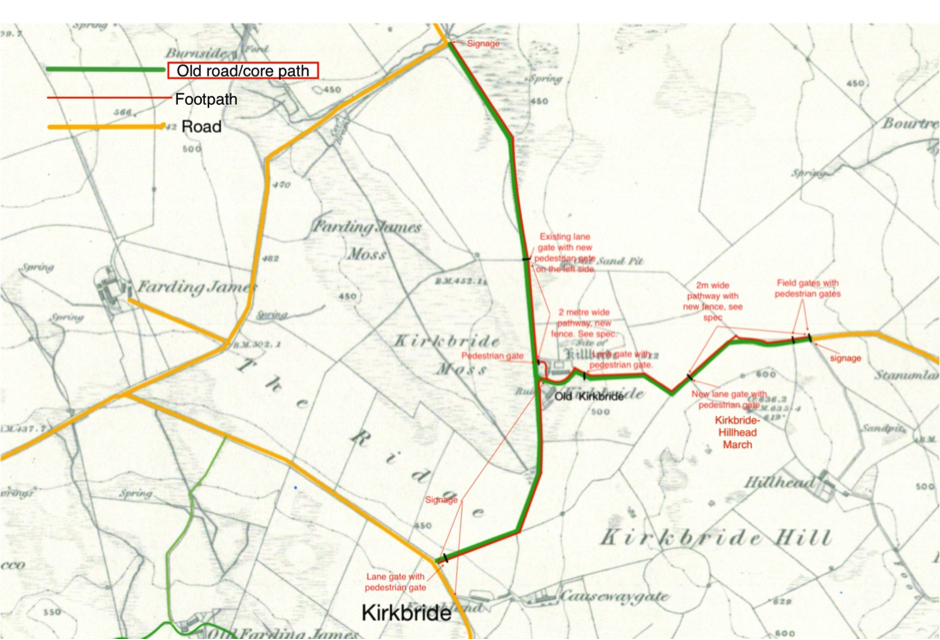
The KPT Development Trust submitted the pathway proposal to D&G Council’s Economy and Resources dept. and on the 2nd Feb. received the wonderful news that the council will undertake the work to reinstate the path. With the agreement of the landowners I prepared the map above, based on the same 1843 OS map, including the detail of gates, fences, hardcore and signage required to make the path useable and safe, and have returned it for action! The expectation is that work will be completed in the 2021-22 financial year.
From the Landwater perspective, there is a slight irony; the edge of the catchment runs along The Ridge then up Kirkbride Hill to Hillhead, so the only part of the pathway inside the catchment is the bottom section from where it crosses The Ridge to the road end near Kirkbride.
Addendum: Fraxinus Excelsior
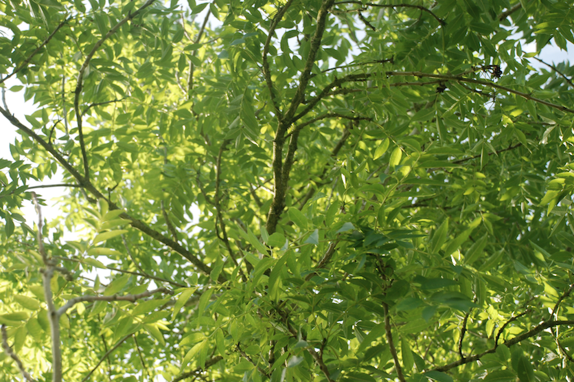
Fraxinus Excelsior is the Latin name for the common Ash tree, native to nearly all of Europe except for southern areas of Italy, Greece and Spain. It is common in the southern regions of Scandinavia, Western Russia and the Caucasus and as far east as Iran, along the southern fringes of the Caspian Sea. It has also been successfully introduced and thrives in the US, Canada and NZ. It is a member of the Oleaceae, the Olive, family which includes Olives, Privet, Lilac, Jasmine and Forsythia. Excelsior, outstanding. The Ash is one our most magnificent trees which, alongside oak, beech and elm, characterise European, and lowland Scottish wood and parkland. In the catchment there are some great examples, perhaps the oldest of which I can see from my kitchen window. It is so familiar a sight to me that till now, for this project, I have never bothered to photograph it.

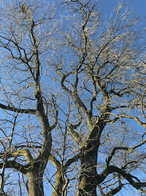
Ash, my favourite of all trees; powerful, athletic yet light and delicate. This one is 22ft. around the bole which would make it over 200 years old, an ancient tree. A sapling during the Napoleonic wars, a youth when James Watt was an old man and when Walter Scott was writing, already a mature Tree when the Cutty Sark was launched at Dumbarton, during the Suffragist movement, two World Wars, a Cold War, and now, the environmental crisis that has perhaps been developing through all its long life.
Much of my feeling for ash comes from the timber. It can be creamy white all the way through or sometimes with a light brown heartwood. It is moderately hard and heavy, easy to work but its true excellence is its springiness, it’s flexibility and its ability to absorb shock which makes it ideal for making structures which have to take multidirectional stresses: carriage and car bodies, parts of wheels, chairs, tool and sports equipment handles, shafts, draw-bars etc.
So why am I talking about Ash? It is a Valete. Our Ashes have been affected by a new fungal disease, Ash Die-back, Chalaraor Hymenoscyphus Fraxineus, which will kill 80% of Ash trees over the next 20 years. Unlike Dutch Elm disease, young trees are more susceptible than older ones so the saplings in the picture at the top of this chapter will probably all die fairly quickly. Older trees like the one pictured immediately above represent their best chance of surviving the period the native stock will need to develop resistance. In Asia, where the disease originated, close relatives of our ash, F. Mandshurica and Chinensis have developed resistance and are only slightly affected.
In the catchment, I estimate that between 20 – 30% of the hardwoods are Ash. The effect will not be just visual, or sentimental; bio-diversity, already under pressure from intensive agriculture and softwood plantation, will be further threatened by this loss of habitat for dependent species which, according to the government Joint Nature Conservation Committee, number 1058 which includes, I am sorry to say, the fungus, Hymenoscythus Fraxineus.
About 25 years ago I transplanted 3 ash saplings from a neighbour’s woodland to our garden. They are now about 30 years old and have thrived and very obviously like their situation. However, the summer of 2020 was very dry and this extra stress on the trees showed up the first signs that Ash Dieback has taken hold in the catchment. All my trees have it.

Compared to Covid19, Ash Dieback is like the Black Death of 1346-53 against a normal year of Influenza. Some estimates reckon the plague carried off 60% of the European population in that first major outbreak but all agree that it changed the social structure of Europe.
From the Landwatership perspective a comparison between these pandemics, Dieback and Covid-19, is fairly simple; 80% loss of Ash trees will change the ecology and could easily have far greater environmental consequences if it triggers a domino effect. Species could be lost.
Covid, on the other hand may well have a beneficial effect. Apart from the tragic personal losses and financial hardships that many people have suffered, one of the outcomes of the pandemic has been that, even in cities, we are spending more time exercising out of doors. While this is good in itself, it also raises the possibility that we will start to pay attention to the condition of where we live.
Here’s a complicated question: given that governments have felt able to financially support direct intervention during the Covid crisis, and that areas of dirty air have unquestionably produced significantly higher Covid death rates, will they put two and two together and act on the public health implications of the environmental crisis.
Well, either way, despite the big government implications of these interventions, Green Recovery is now a common mantra and so long as we, the people, continue to demand it there is a chance we will get it.

No part of us is unaffected by where we live, and no part of where we live is unaffected by us.